
Visited countries map generator
Interactive visited countries map
On travel website wcifly.com, you can generate a map of countries visited, simply by selected the list of countries, and copying the given link to an image automatically generated.
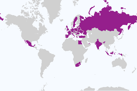
Map of visited countries
Want to see how much of the world you have seen, and to share it with your friends on social medias ?
The Visited States Map Generator on travel website www.wcifly.com just does that !
Where Can I FLY? Visited states map generator
Generate map of countries visited
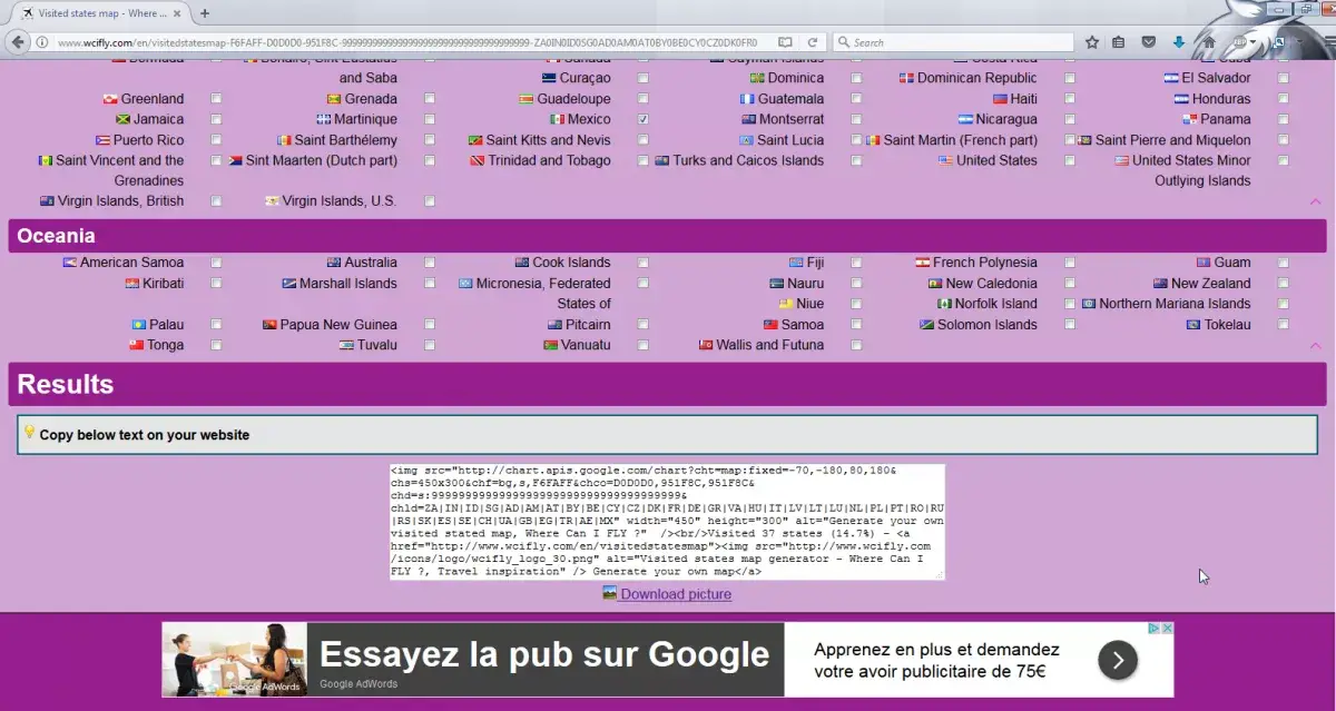
Using the quick links, jump to the continents you have visited, and select one by one the countries or states you have been to.
The countries are grouped by continent, and ordered by country name, making it easy to find them.
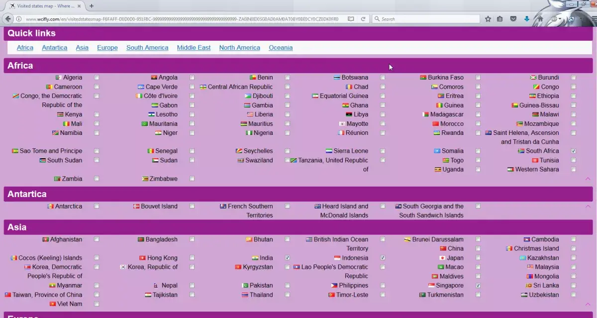
Image will automatically update itself right away – it is also possible to personalize the map, for example by selecting another color for the visited countries, a different color for the seas, and a different one for the states that haven’t been visited yet.
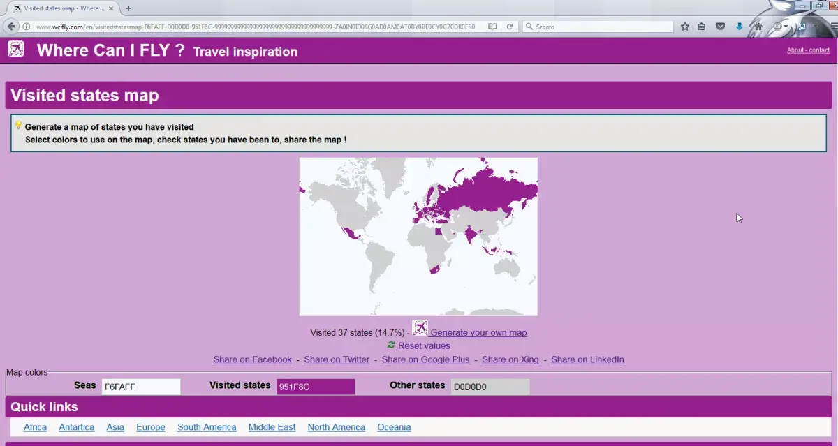
Keep selecting the visited places until you have found all of them, and scroll up to share on most social medias (Facebook, Twitter, Google+, Xing, LinkedIn), or scroll to the bottom of the page to download the image, and / or get a code to copy and paste on your website, or to post on online forums for example.
The picture can also be saved locally, simply by right clicking on it, and saving it as a specific file on local computer, from where it can further be edited, or shared by email for example.
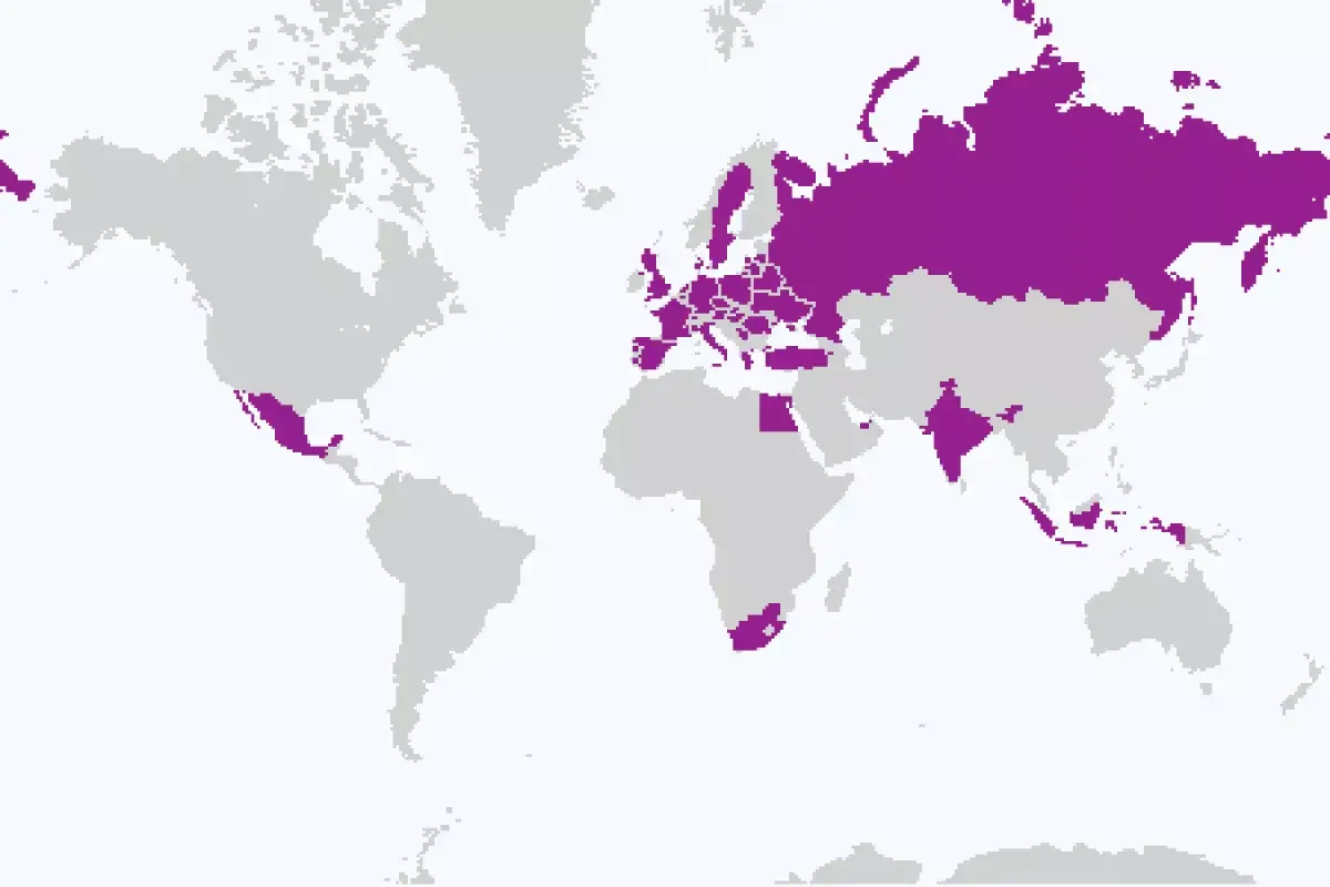
Where Can I FLY? Visited countries map generator
Where Can I FLY ? Travel inspiration and booking
Generate world map with countries highlighted
The map can of course be used for any purpose, simply by choosing the colors of seas, highlighted countries, and countries not highlighted.
It can then be saved and shared, and represent any highlight of countries necessary, for example to complete a professional PowerPoint presentation with the visualization of company offices, or to include in a school project.